Industrial for lease
active ListedSublease: Office/Warehouse Suite 411, Austin Industrial Park
More Austin commercial real estateAustin warehouses and industrial property
Lease rate
$23/SF/yr
Available spaces
1 suite- Suite 411 $23/SF/yr1,200 SF · Nov 6, 2026
Overview
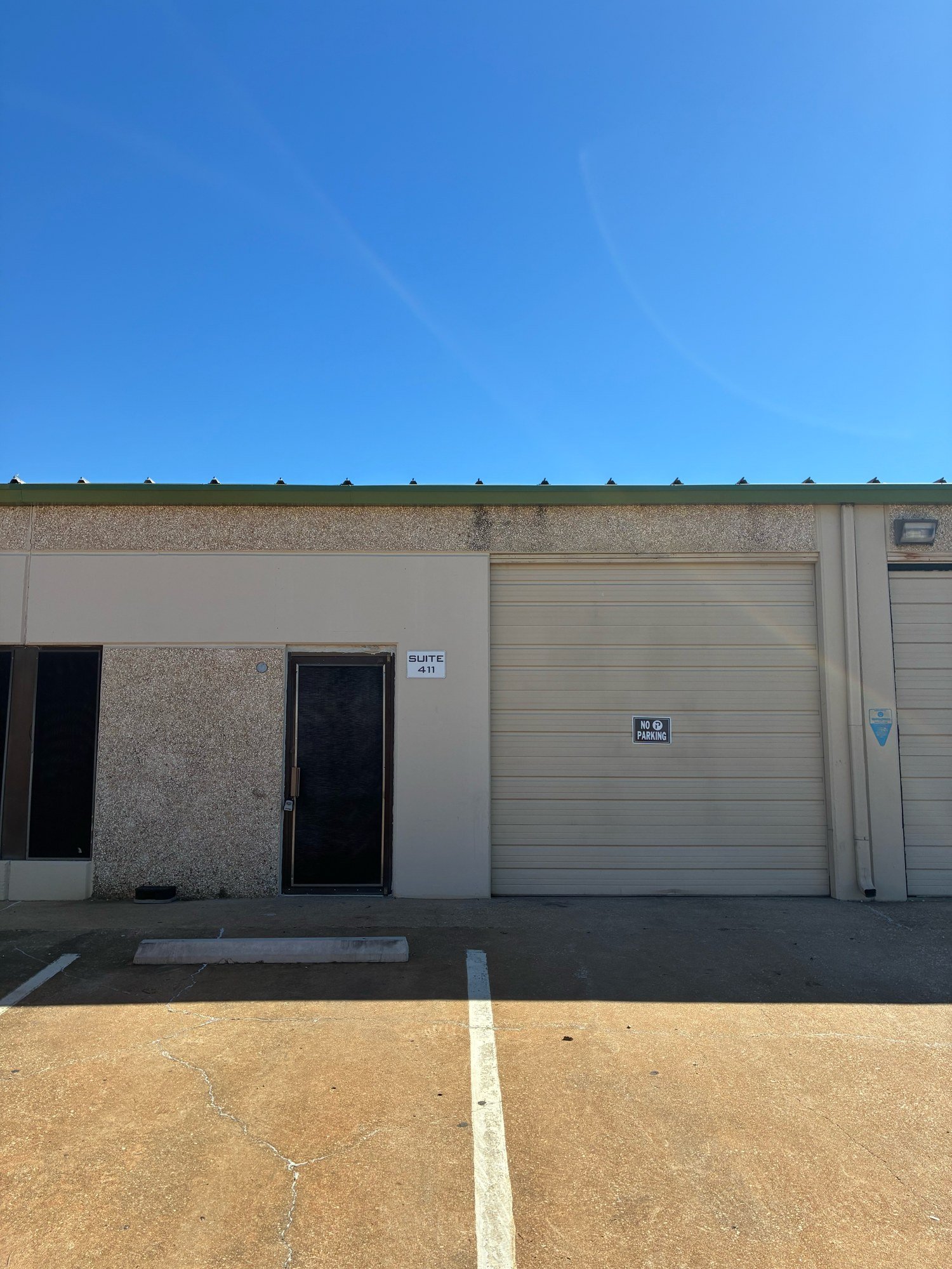
- Vacant, move-in ready 1,200 SF first-floor suite available now through March 31, 2027.
- Grade-level roll-up door, glass front entry, and 120/240-volt power.
- Air conditioning, half bath with utility sink, parking, and 24-hour access.
Short-term sublease of an empty, move-in ready office/warehouse suite in Austin Industrial Park, just off Highway 71 near the airport, Interstate 35 and the 130 Toll Road. One grade-level roll-up door plus glass front door, 120 and 240 volt power, air conditioning, half bathroom with utility sink, sealed concrete floor, parking, light industrial zoning, 24-hour access. $2,300 per month plus utilities, first and last month due at signing, through March 31, 2027, landlord approval required. Contact john-christian.foster@puresteelco.com for a showing.
Property details
Power
- Voltage
- 120/240V
Industrial Features
- Drive-in Doors
- 1
Due diligence
 Find a commercial property inspector Book a certified commercial inspector in this area.
 Investment Property Analyzer Run the numbers on this property before you offer. Free.
From our partner CCPIA — the Certified Commercial Property Inspectors Association
Location & area
Getting there
Straight-line distance- Highway exit
- TX 71 · 0.7 mi
- Freight rail
- UP Austin Subdivision · 3.1 mi
- International airport
- Austin-Bergstrom International Airport (AUS) · 3.9 mi
Within a mile: 13 restaurants · 18 shops · 6 grocery stores · 0 schools · 4 parks
Nearby brands
Nearest location · within 1 mi- Shell Fuel
- 0.3 mi
- Meson Sandwiches Food
- 0.4 mi
- Apple Store Retail
- 0.5 mi
- McDonald's Food
- 0.5 mi
- Exxon Fuel
- 0.6 mi
Distances and places from © OpenStreetMap contributors.
Demographics
U.S. Census ACS · 2019–2023 · LEHD| Statistic | 1 mi | 3 mi | 5 mi |
|---|---|---|---|
| Population | 3,784 | 105,820 | 249,147 |
| Jobs (people working here) | 6,665 | 68,428 | 301,328 |
| Daytime population (est.) | 8,201 | 120,824 | 422,678 |
| Median household income | $69,179 | $74,575 | $88,621 |
Household income
Share of households · 1 mi- Under $25k
- 14%
- 241
- $25k–$50k
- 23%
- 399
- $50k–$100k
- 35%
- 595
- $100k–$200k
- 23%
- 398
- $200k+
- 4%
- 68
Population by age
Share of residents · 1 mi- Under 18
- 21%
- 810
- 18–24
- 3%
- 98
- 25–34
- 29%
- 1,097
- 35–44
- 16%
- 595
- 45–54
- 10%
- 381
- 55–64
- 12%
- 446
- 65–74
- 5%
- 205
- 75+
- 4%
- 152
Housing
Share of housing units · 1 mi- Owner occupied
- 29%
- 545
- Renter occupied
- 62%
- 1,156
- Vacant
- 8%
- 155
Median income by age
Age of householder · 1 mi- 25–44
- $79,790
- 45–64
- $75,205
- 65+
- $42,048
Jobs by industry
Share of jobs · 1 mi- Retail, food & lodging
- 15%
- 980
- Health care
- <1%
- 23
- Education
- <1%
- 27
- Professional & finance
- 16%
- 1,088
- Construction & manufacturing
- 40%
- 2,691
- Wholesale & logistics
- 17%
- 1,156
- Government
- 0%
- 0
- Other services
- 11%
- 700
Education
Share of adults 25+ · 1 mi- No HS diploma
- 12%
- 355
- High school
- 18%
- 518
- Some college
- 28%
- 792
- Bachelor's
- 35%
- 1,003
- Graduate
- 7%
- 208
Race & ethnicity
Share of residents · 1 mi- White
- 45%
- 1,691
- Black or African American
- 5%
- 182
- Asian
- 3%
- 101
- Two or more races
- 25%
- 961
- Other
- 22%
- 849
Hispanic or Latino, of any race 49%
Natural hazard risk
FEMA National Risk Index · December 2025- Overall
- Low
- Tornado
- High
- Hail
- High
- Heat wave
- Moderate
- Flooding (inland)
- Low
- Strong wind
- Low
- Lightning
- Low
- Cold wave
- Low
- Winter weather
- Low
- Wildfire
- Very Low
- Hurricane
- Very Low
- Ice storm
- Very Low
- Drought
- Very Low
- Earthquake
- Very Low
- Landslide
- Very Low
Ratings are for the census tract, relative to all U.S. tracts — not a parcel-level model.
- EPA-Tracked Facilities Within 1 Mile
- 178
- Toxic-Release Facilities Within 1 Mile
- 1
- EPA Severe Violators Within 1 Mile
- 0
- Open Leaking-Tank Cases Within ½ Mile
- 0
- Leaking-Tank Releases Within ½ Mile
- 5
- Underground Tank Sites Within ¼ Mile
- 4
- In FEMA Special Flood Hazard Area
- No
Location & Zoning
- FEMA Flood Zone
- X
- Opportunity Zone
- No
Public data for 5214 Burleson Road — the building's own page, which stays up after this listing closes.