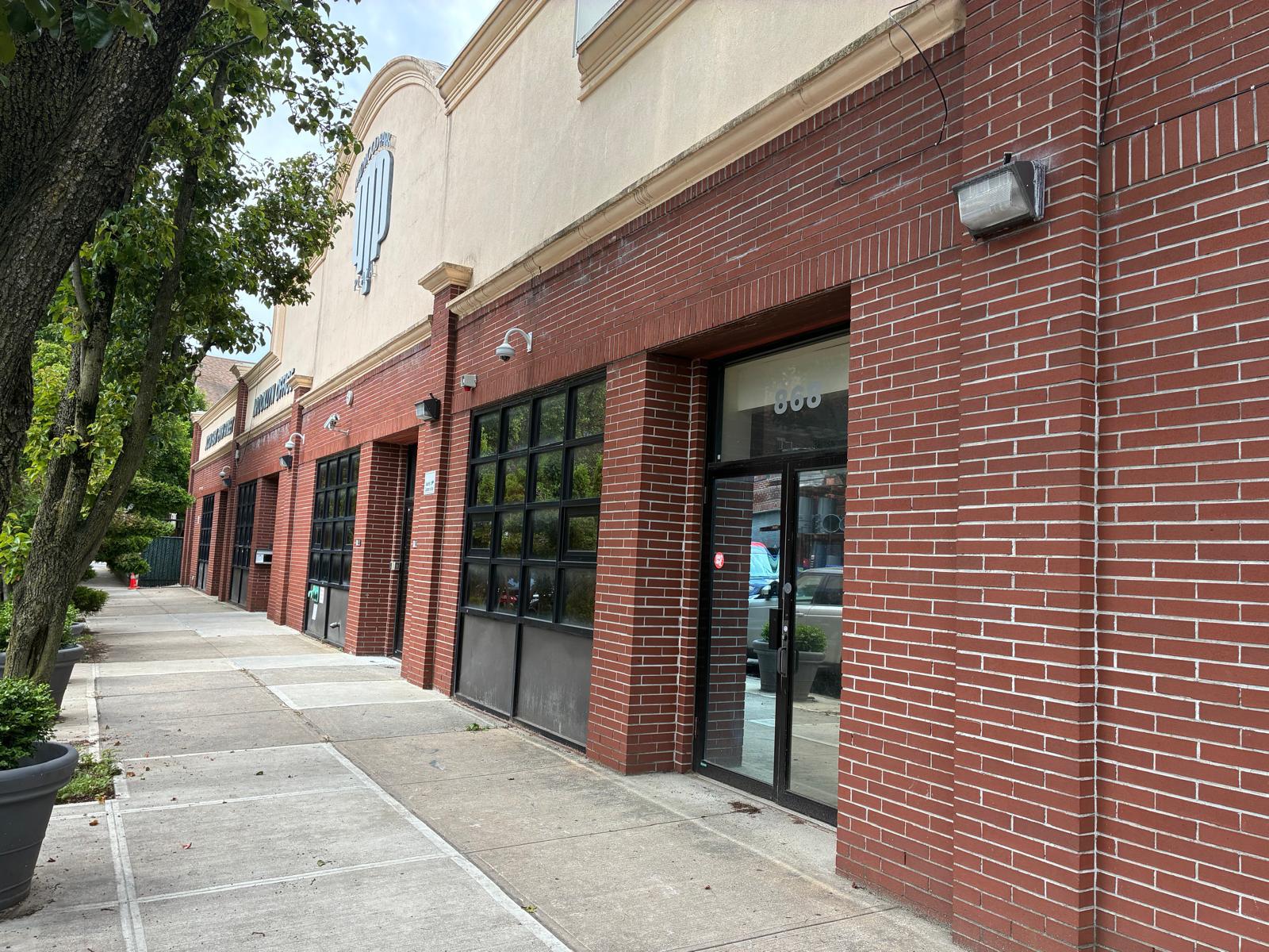
Office for sale
active ListedBrooklyn Commercial Property Offered for $10M
Asking price
$10,000,000
Building
16,000 sqft
Lot
16,000 sqft

Overview
- 866 East 29th Street, Brooklyn, NY 11210 | $10,000,000. Approximately 16,000 SF in Midwood near Brooklyn College, with a column-free interior, 12–20 ft ceilings, and roughly 160 ft of street frontage. Potential educational or medical use, subject to approvals.
- Near Brooklyn College, this approximately 16,000 SF Midwood building offers an open layout buyers can adapt to their needs. Explore the potential for educational, healthcare, nonprofit, or community facility use, subject to verification and required approvals.
- Approximately 160 feet of frontage along East 29th Street gives this Midwood property a broad street presence and a prominent address near Brooklyn College.
The property at 866 E. 29th St. in Brooklyn is offered for sale at an asking price of $10,000,000 and is listed as 16,000 square feet. The flyer names professional offices, educational use, and nonprofit organizations as potential uses, subject to zoning and required approvals.
Property details
Pricing & Size
- Building Size
- 16,000 sqft
Public record
County record
Researched Nov 9, 2026Tax lots
1 lot| Parcel number | Assessed | Market |
|---|---|---|
| 30757400741 | $1,620,000 | $3,600,000 |
Sources
- 1 data.cityofnewyork.us · data.cityofnewyork.us
- 2 data.cityofnewyork.us · data.cityofnewyork.us
- 3 zr.planning.nyc.gov · zr.planning.nyc.gov
Figures as the county publishes them. Each source links to the page it was read from and, where the county published a document, to a copy kept on the day it was read.
Due diligence
 Find a commercial property inspector Book a certified commercial inspector in this area.
 Investment Property Analyzer Run the numbers on this property before you offer. Free.
From our partner CCPIA — the Certified Commercial Property Inspectors Association
Location & area
Getting there
Straight-line distance- Highway exit
- NY 27 Exit 5 · 1.9 mi
- Freight rail
- Bay Ridge Branch · 0.1 mi
- Airport
- New York Skyports Incorporated Seaplane Base (NYS) · 7.4 mi
- International airport
- John F. Kennedy International Airport (JFK) · 8.6 mi
Within a mile: 54 restaurants · 131 shops · 35 grocery stores · 29 schools · 36 parks
Nearby brands
Nearest location · within 1 mi- Ramada Hotel
- 0.1 mi
- Applebee's Food
- 0.1 mi
- Key Food Grocery
- 0.1 mi
- Target Retail
- 0.2 mi
- Aldi Grocery
- 0.2 mi
Distances and places from © OpenStreetMap contributors.
Demographics
U.S. Census ACS · 2019–2023 · LEHD| Statistic | 1 mi | 3 mi | 5 mi |
|---|---|---|---|
| Population | 139,519 | 1,125,121 | 2,326,251 |
| Jobs (people working here) | 37,887 | 344,402 | 718,478 |
| Daytime population (est.) | 109,443 | 961,845 | 1,992,781 |
| Median household income | $78,897 | $75,380 | $76,643 |
Household income
Share of households · 1 mi- Under $25k
- 16%
- 8,123
- $25k–$50k
- 17%
- 8,575
- $50k–$100k
- 29%
- 14,717
- $100k–$200k
- 27%
- 13,656
- $200k+
- 12%
- 6,191
Population by age
Share of residents · 1 mi- Under 18
- 22%
- 30,955
- 18–24
- 8%
- 11,147
- 25–34
- 14%
- 20,156
- 35–44
- 13%
- 18,616
- 45–54
- 12%
- 17,069
- 55–64
- 12%
- 17,057
- 65–74
- 11%
- 15,632
- 75+
- 6%
- 8,887
Housing
Share of housing units · 1 mi- Owner occupied
- 33%
- 18,049
- Renter occupied
- 61%
- 33,213
- Vacant
- 6%
- 3,515
Median income by age
Age of householder · 1 mi- Under 25
- $50,867
- 25–44
- $83,714
- 45–64
- $88,408
- 65+
- $63,155
Jobs by industry
Share of jobs · 1 mi- Retail, food & lodging
- 11%
- 4,037
- Health care
- 52%
- 19,518
- Education
- 17%
- 6,565
- Professional & finance
- 10%
- 3,686
- Construction & manufacturing
- 3%
- 1,226
- Wholesale & logistics
- 2%
- 577
- Government
- 1%
- 374
- Other services
- 5%
- 1,904
Education
Share of adults 25+ · 1 mi- No HS diploma
- 14%
- 13,437
- High school
- 23%
- 22,638
- Some college
- 24%
- 23,205
- Bachelor's
- 23%
- 22,095
- Graduate
- 16%
- 16,042
Race & ethnicity
Share of residents · 1 mi- White
- 29%
- 40,983
- Black or African American
- 46%
- 64,155
- Asian
- 10%
- 13,420
- Two or more races
- 8%
- 11,019
- Other
- 7%
- 9,942
Hispanic or Latino, of any race 11%
Natural hazard risk
FEMA National Risk Index · December 2025- Overall
- Very Low
- Heat wave
- Moderate
- Winter weather
- Moderate
- Hurricane
- Low
- Strong wind
- Low
- Cold wave
- Low
- Earthquake
- Low
- Flooding (inland)
- Very Low
- Tornado
- Very Low
- Hail
- Very Low
- Lightning
- Very Low
- Ice storm
- Very Low
- Landslide
- Very Low
Ratings are for the census tract, relative to all U.S. tracts — not a parcel-level model.
- EPA-Tracked Facilities Within 1 Mile
- 1,043
- Toxic-Release Facilities Within 1 Mile
- 1
- EPA Severe Violators Within 1 Mile
- 0
- Open Leaking-Tank Cases Within ½ Mile
- 0
- Leaking-Tank Releases Within ½ Mile
- 10
- Underground Tank Sites Within ¼ Mile
- 20
- In FEMA Special Flood Hazard Area
- No
Location & Zoning
- Zoning
- R-M
- FEMA Flood Zone
- X
- Opportunity Zone
- Yes
Public data for 866 East 29th Street — the building's own page, which stays up after this listing closes.